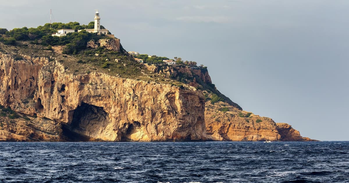
Punta del Cavall and Torre de les Caletes (Benidorm)
Punta del Cavall: the watchtower above Benidorm’s coves
Punta del Cavall (or Punta de les Caletes) is the headland that closes Benidorm bay to the north, at the southern end of the Serra Gelada Natural Park. On top, 70 metres above the sea, stands the Torre de les Caletes, also known as Torre del Seguró or Torre Punta del Cavall: a 16th-century watchtower, built before 1561 and listed in Antonelli’s report, protected as a Bien de Interés Cultural since 1996. Below it lie Benidorm’s two “wild” coves, Tio Ximo and l’Almadrava, with Benidorm Island as backdrop.
It is one of the most rewarding walks on the Costa Blanca: a paved track closed to traffic, suitable for wheelchairs and pushchairs, 2 km to the tower, with views over Serra Gelada and the bay all the way.
The tower: what you’re looking at
The Torre de les Caletes is truncated-cone shaped and solid, about 8 metres across at the base and 7 metres of surviving height. It was part of the coastal watchtower network against Barbary raids; tradition attributes it to Philip II. It was bombarded and burnt by the British during the Peninsular War and left in ruins.
In 2017 the Spanish Coastal Authority spent €350,000 consolidating the tower and anchoring the headland’s cliff with steel mesh. The decision was to conserve it as it stands rather than rebuild, for lack of documentation on its original appearance. The 2017–2018 excavations turned up espadrilles, water pottery, remains of vine cuttings for the warning fires and lead musket balls, catalogued by the MARQ museum and exhibited in 2023 at Benidorm’s Museu Boca del Calvari (“Guardians of the Sea”).
How to get to Punta del Cavall
Trailhead: from Avenida del Mediterráneo at Punta de Pinet (the end of Levante beach), or from the barrier at the junction of Alcalde Manuel Catalán Chana and Sierra Dorada (Rincón de Loix). From there the paved track, closed to vehicles, climbs gently to the tower: 2 km, about 150 m of accumulated climb, easy. It is wheelchair and pushchair friendly.
Circular route: linking up with the Creu de Benidorm (the cross) makes a loop of about 7 km, around 3 hours with stops. There is no shade anywhere on the route: water, hat and sunscreen, and in summer go early.
Parking: blue-zone (ORA) parking on Avenida del Mediterráneo (pay via the Moviltik app) or before the barrier on Calle Dos Calas. Difficult in August; TRAM L3 and urban buses drop you near Levante beach.
The coves: Tio Ximo and l’Almadrava
Cala del Tio Ximo (Platgeta del Ti Ximo): about 60 metres of sand with rocks and gravel. You walk down from the Punta de l’Escaleta viewpoint. It has a lifeguard and flag in season, though it is officially listed as a bathing zone “not controlled” by the regional government. Very good for snorkelling and kayaking.
Cala de l’Almadrava: about 100 metres of fine sand and rocks, with a lifeguard and foot showers. It has shared naturist use, but the town council points out it is not officially a nudist beach. Benidorm’s official snorkelling trail starts here: a loop down to about 8 metres, with posidonia, white seabream, striped seabream and Padina pavonica algae.
In the 2026 high season (1 June–30 September) the council posts one lifeguard at each of the two coves.
Swimming round Punta Llisera from l’Almadrava you reach the Cova del Barber (Cova de l’Aigua), but it is a dangerous passage with children and in any swell.
Best time to visit
Autumn, winter and spring are perfect for the walk (low light, no heat, no crowds). In summer, go up first thing and drop down to the coves afterwards: in calm seas the Almadrava snorkelling is among the best in the Marina Baixa.
What else to see
- Punta de l’Escaleta viewpoint — the postcard of Benidorm Island
- Creu de Benidorm — the cross on Serra Gelada, with views to Altea and Albir
- Serra Gelada Natural Park — the whole range, from Benidorm to Albir
- Levante beach — 5 minutes away, with full facilities
- Museu Boca del Calvari — where the tower’s finds are exhibited
- The city itself in our Benidorm guide
Practical information
| Location | Punta del Cavall, Benidorm (Serra Gelada Natural Park) |
| Route | 2 km each way on paved track; 7 km loop with the Creu |
| Difficulty | Easy; wheelchair friendly up to the tower |
| Climb | About 150 m |
| Shade | None |
| Parking | Blue zone on Av. del Mediterráneo (Moviltik) |
| Coves | Tio Ximo (60 m) and l’Almadrava (100 m), lifeguards in summer |
| Snorkelling | Official trail at l’Almadrava |
| Tower | 16th century, listed 1996, consolidated 2017 |
| Best season | Oct–May for the walk; summer for the coves |
Discover more about
Benidorm
Benidorm: the anomaly of this coast. 5 km of fully equipped fine sand, the most accessible shoreline in the Marina Baixa and the only one you can visit without a car. Beaches, 2026 Blue Flags, the island and its marine reserve, and the real fiesta calendar.
📖 Guides to Benidorm
- Benidorm Beaches and Coves: Complete Guide 2026 The 5 beaches and coves of Benidorm: Levante, Poniente, Mal Pas and the Tio Ximo and Almadrava coves. Lengths, 2026 Blue Flags, accessibility, snorkelling and Benidorm Island with the La Llosa marine reserve.