Montgó Natural Park
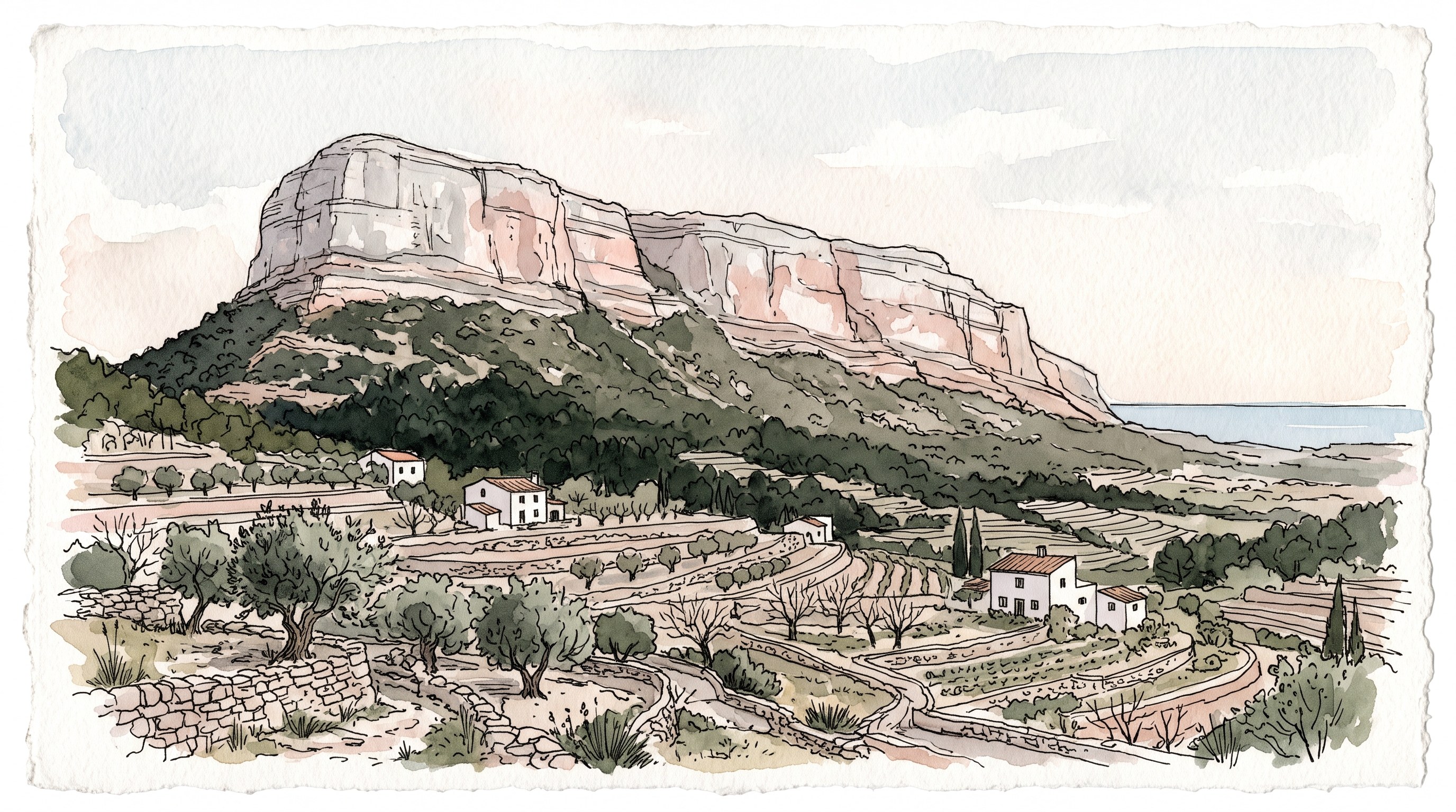
The Montgó: the mountain between Dénia and Xàbia
The Montgó is the massif that dominates the whole Marina Alta: 753 metres dropping sheer onto the plains of Dénia, Xàbia and Ondara, and which from the sea looks like an elephant’s head. It was declared a natural park by Decree 25/1987 of the Valencian regional government and protects 2,117.68 hectares across Dénia and Xàbia, including the Les Planes plateau and the Cap de Sant Antoni.
It forms part of the Natura 2000 network (code ES5211007), and off its eastern tip lies the Cap de Sant Antoni Marine Reserve, with 110 hectares protected since 1993 according to Xàbia town council.
More than 650 plant species grow here according to the regional government (Xàbia council puts the figure at 800), among them the herba santa (Carduncellus dianius), an endemism almost exclusive to this massif. And more than 150 vertebrate species: Bonelli’s eagle, peregrine falcon, eagle owl, wild boar, badger and genet.
The official trails
The park has ten colour-coded waymarked trails. These are the ones the regional government publishes with full data:
| Trail | Route | Distance | Climb | Duration | Difficulty |
|---|---|---|---|---|---|
| Yellow (3) | Cova de l’Aigua and Racó del Bou | 5.5 km | 110–364 m | 3 h 30 | Medium · circular |
| Orange (5) | Camí de la Colònia – Summit | 6.1 km | 110 → 751 m | 3 h 05 | High · linear |
| Grey (6) | Shooting range – Summit | 3.8 km | 210 → 751 m | 2 h | High · linear |
| Red (9) | Xàbia harbour – Cap de Sant Antoni | 1.7 km | 5 → 161 m | 45 min | Medium · linear |
The other six (Benimaquia–Coll de Pous, Jesús Pobre–Summit, Camí de la Colònia–Cova del Gamell, Torre del Gerro–Molins, Recreation area–Molins and Cova Tallada) are described on the park’s website.
The yellow trail, the best for general visitors
It starts on the Camí de la Colònia, next to the Pare Pere hermitage, where a chain blocks motor vehicles. It runs along the shaded northern face and passes an abandoned farming colony, the Cova de l’Aigua and the rock formations of the Racó del Bou. There is a short there-and-back variant of about 3 km to the cave only.
The Cova de l’Aigua is worth the detour on its own: at around 350 metres altitude, it preserves a Roman inscription dated AD 238 beside the entrance, along with remains of Roman hydraulic works. It is the most visited cave in Dénia.
The summit trails
The orange starts at the same Pare Pere hermitage and passes the Creueta de Dénia. The grey is the shortest ascent: it begins at the shooting range car park, reached by dirt track from the CV-736, follows a zigzag path on the old mule track and finishes the last 400 metres scrambling over limestone, using your hands. It corresponds to the waymarked PR-CV 355 route (white and yellow markings).
The regional government’s own warning about these trails: “steep gradients and loose stones require extreme caution”. On windy or wet days, forget the summit: the limestone gets slippery and there are exposed sections on the ridge. In exchange, on clear days you can see Ibiza and Mallorca.
The Cova Tallada: compulsory free booking
It is the most in-demand spot in the park and the one with the strictest rules. Access is regulated with compulsory, free advance booking during these 2026 windows:
- 28 March – 13 April
- 28 April – 5 May
- 15 June – 15 October
Conditions: maximum 5 people per booking, only up to 10 days in advance, in two-hour slots (9-11, 11-13, 13-15, 15-17, 17-19, 19-21) and with a maximum stay of 1 h 30 from the authorised time. You must carry the authorisation (printed or on your phone) and your ID, and show it at the start of the path. It applies whether you arrive on foot or by sea.
Book on the regional government’s website, procedure 20328. It is free: be wary of any site charging to arrange it.
The regional government’s official warning, in its own words: “the route can be dangerous due to slippery sections of the path and the impact of the waves”. There is no mobile coverage in the cave area. Emergencies: 112.
Fire risk: the restriction that really matters in summer
When the regional government activates level 3 fire-risk pre-emergency (PREVIFOC), travelling on forest tracks and paths in natural parks is banned for any vehicle, by bicycle and on foot. It is not a recommendation but a total ban, and in the summer of 2026 it was declared several times, with the Montgó explicitly “sealed off” along with the Penyal d’Ifac and the Marjal de Pego-Oliva.
It is announced only hours in advance, so check the level the same day before leaving home.
Other park rules: no camping, no fires, no collecting plants and no disturbing wildlife.
The interpretation centre
- Finca Bosc de Diana, Camí Sant Joan, 1, Dénia, inside the municipal Bosc de Diana gardens.
- Hours: 9:00-14:00 Monday, Wednesday, Friday and Saturday. Other days by appointment. Closed Sundays.
- Phone: 96 646 71 55 / 679 196 461 · parque_montgo@gva.es
- Accessible exhibition, with audio guides in five languages, models, marine and terrestrial dioramas and a room on the Cap de Sant Antoni seabed reserve.
Getting there and parking
By road: AP-7/A-7 exit 62 (Ondara) or the N-332 towards Ondara-Dénia. The park’s official website only details car access; by public transport, the most practical option is TRAM line 9 to Dénia or Gata and a taxi from there.
Documented trailhead car parks:
- Dénia shooting range — start of the grey trail, by dirt track from the CV-736
- Camí de la Colònia / Pare Pere hermitage — start of the yellow, blue and orange trails
- Cap de Sant Antoni — there is parking about 300 metres before the lighthouse, on the right; best to leave the car there
- Xàbia harbour — start of the red trail
- Bosc de Diana — for the interpretation centre
Best season
Spring (March-May) is the best: flowering, good temperatures for the summit and the massif at its finest. Autumn comes second, with clean air and visibility as far as the Balearics. In summer, only early morning, and after checking the fire-risk level; the summit trails are exposed rock with no shade. The yellow trail, on the shaded side, is the most bearable in heat.
Practical information
| Declaration | Decree 25/1987 (Valencian regional government) |
| Area | 2,117.68 ha |
| Highest point | 753 m |
| Municipalities | Dénia and Xàbia |
| Protection | Natura 2000 (ES5211007) + Cap de Sant Antoni Marine Reserve |
| Trails | 10 colour-coded |
| Cova Tallada | Compulsory free booking (proc. 20328) |
| Camping | Banned |
| Summer | Access banned at fire-risk level 3 |
| Interpretation centre | Bosc de Diana, Dénia · 96 646 71 55 |
What’s inside and nearby
- The summit (753 m), the Creueta de Dénia, the Cova de l’Aigua, the Cova del Gamell, the Iberian settlement of Benimaquia and the Torre del Gerro
- The Cap de Sant Antoni and its marine reserve, and the Cova Tallada
- Les Rotes in Dénia and the Port de Xàbia
- Dénia Castle, from which you see the whole massif
- The beach guides for Dénia and Jávea
Discover more about
Dénia
Dénia: capital of the Marina Alta, a UNESCO Creative City of Gastronomy since 2015, with 20 km of coast split into two opposite halves (sandy Les Marines, rocky Les Rotes). Castle, red prawn, the Montgó and the real fiesta calendar.
Frequently asked questions
Do you need to book to enter the Montgó?
For the park in general, no. Only for the Cova Tallada, where booking is compulsory and free during the regulated windows: in 2026, 28 March to 13 April, 28 April to 5 May and 15 June to 15 October. It is arranged solely on the regional government's website (procedure 20328). Beware of sites charging for this permit: it is free.
How does the Cova Tallada booking work?
Maximum 5 people per booking, only up to 10 days in advance, in two-hour slots (9-11, 11-13, 13-15, 15-17, 17-19, 19-21) and with a maximum stay of 1 hour 30 minutes. You must carry the authorisation and your ID. It applies whether you arrive on foot or by sea.
Which is the easiest trail and which the hardest?
The most manageable is the red trail (Xàbia harbour to Cap de Sant Antoni): 1.7 km, 45 minutes, medium difficulty. The hardest are the orange (6.1 km to the summit, 3 h 05) and the grey (3.8 km, 2 h), both rated high: the regional government only recommends them to experienced mountain walkers, and the final stretch requires using your hands.
Can you climb the Montgó in summer?
It depends on the day. When level 3 fire-risk pre-emergency (PREVIFOC) is activated, travelling on forest tracks and paths in the park is banned, including on foot and by bicycle. It was declared several times in the summer of 2026. Check the level the same day before setting out: it is announced only hours ahead.
Can you camp or light a fire?
No. Camping is banned in all Valencian natural parks, the Montgó included, as are lighting fires, collecting plants and disturbing wildlife.
📖 Guides to Dénia
- Dénia Beaches and Coves: Complete Guide 2026 All 12 beaches and coves of Dénia, north to south: Les Marines (sand, seven Blue Flags) and Les Rotes (rocky coves inside a marine reserve). Access, parking, facilities, snorkelling and the summer traffic restriction at Les Rotes.
- Marina Alta Summer Festivals 2026: Guide and Programmes by Town Complete guide to the Marina Alta summer festivals 2026: dates and day-by-day programme by town. Bous a la mar, Moros i Cristians, mascletàs and processions in Dénia, Xàbia, Calp, Benissa, Moraira and more.